I am here Introduction > The Karlovy Vary Region > The Karlovy Vary Region in a nutshell
The Karlovy Vary Region in a nutshell
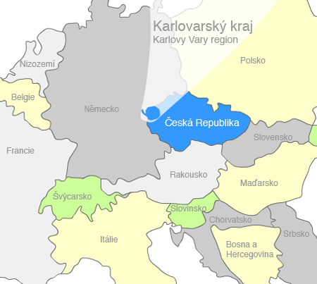
The Karlovy Vary Region is situated in the west of the Czech Republic. To the north and west it creates a border with Germany, to the east it borders with the Ústí Region and to the south with the Plzeň Region. It spans over 3310 km2, which represents 4.2 % of the total area of the Czech Republic. 44.1 % of the Karlovy Vary Region area is covered with forest.
The Karlovy Vary Region on the map of Europe

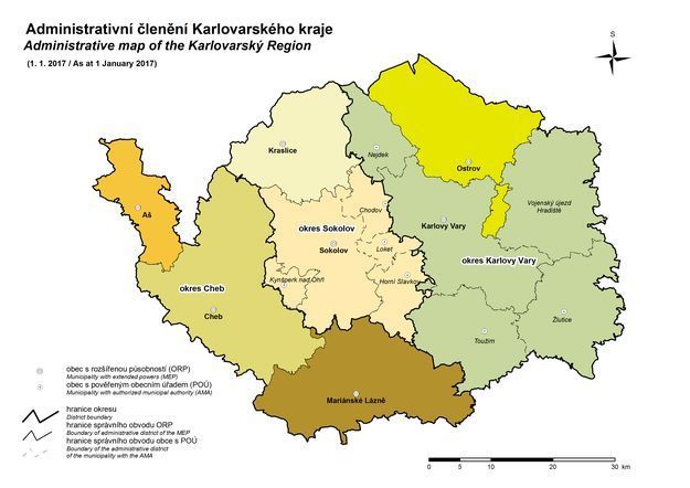
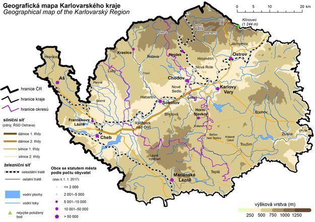
Administrative division and geographic characteristics
People and area
| Administrative district (ORP) | Population (31 Dec. 2017) | Area (km2) | Population density (people/km2) |
|---|---|---|---|
| Aš | 17 645 | 143,76 | 122,7 |
| Cheb | 49 944 | 496,81 | 100,5 |
| Karlovy Vary | 87 280 | 1 171,45 | 74,5 |
| Kraslice | 13 177 | 264,54 | 49,8 |
| Mariánské Lázně | 23 976 | 405,33 | 59,1 |
| Ostrov | 28 048 | 339,29 | 82,7 |
| Sokolov | 75 618 | 489,19 | 154,6 |
| Karlovarský kraj | 295 686 | 3 310,37 | 89,3 |
Source: Czech Statistical Office (CSO) in Karlovy Vary (www.kvary.czso.cz)
The largest cities
| City | Population (31 Dec. 2017) |
|---|---|
| Karlovy Vary | 48 776 |
| Cheb | 32 171 |
| Sokolov | 23 438 |
| Ostrov | 16 865 |
| Chodov | 13 547 |
| Mariánské Lázně | 12 970 |
| Aš | 13 245 |
| Nejdek | 7 791 |
| Kraslice | 6 802 |
Source: Basic data regarding various cities in the Karlovy Vary Region as of 31 December 2011, Czech Statistical Office in Karlovy Vary (www.kvary.czso.cz)
Characteristics of the administrative districts in the Karlovy Vary Region
Brief characteristics of the administrative districts of communities with extended powers (ORP) presented on the website of the Czech Statistical Office in Karlovy Vary – here.
Other statistical information about the region
Investment Opportunities in the Karlovy Vary Region
Karlovarská agentura rozvoje podnikání, p. o.
The Business Development Agency of Karlovy Vary Region (KARP)
Závodní 278,
360 18 Karlovy Vary
Podnikatelský inkubátor KANOV, 4nd floor


