bss BÁŇSKÁ STAVEBNÍ SPOLEČNOST s. r. o. Industrial Zone

| Town: |
Sokolov |
| Population: |
24.111 |
| Cadastral area: |
Sokolov (752223) |
| District: |
Sokolov |
| Site area (ha): |
cca 15.10, of which available:0.00 |
| Type of locality: |
partly built-up area |
| Ownership |
Number of owners |
Ownership interest in % |
Restriction of ownership rights |
| Private |
1 |
100% |
None |
| Municipal |
0 |
0% |
None |
| State |
0 |
0% |
None |
| Church |
0 |
0% |
None |
| Not determined |
0 |
0% |
None |
| Total number of owners |
1 |
|
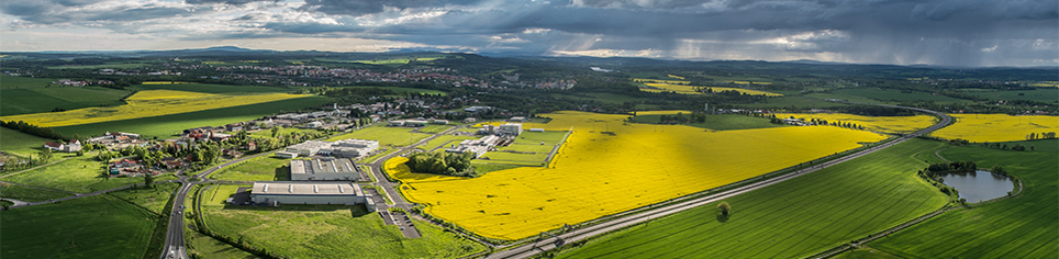
Brief characteristics:
The industrial zone of the total area 15.1 ha is situated directly on the terrritory of the town of Sokolov along Chebská Street, which connects Sokolov and Dolní Rychnov. On the premises there are administrative buildings, halls and warehouses. A transport connection to the premise sis along the current local roads and it is linked to the road R6 Cheb - Karlovy Vary. On the premises there is a railway siding connected to the railway network available. The zone can be used partly for heavy industrial production and storage (machinery, packing facility) and partly for light mixed production, craftman´s production and storage.
Limits: Administrative buildings – prefabricated with a flat roof, the original chateau buildings of stone with a saddle-shaped roof, the remaining warehouses made from steel with a flat roof. With regard to the previous mining activities both of deep or surface character, it is recommended to carry out an expert´s opinion on the influence of mining and a constructional geological research.
| Site use according to spatial planning documentation: |
Industrial production and storage, mixed production |
| Spatial planning documentation: |
yes |
| Spatial planning decision: |
yes |
| Investment plans: |
no |
| Government aid: |
no |
| Ecological burden: |
no |
| Civic amenities: |
Kindergarden, basic school, secondary school, university, library, theatre, sports stadium, hospital, post office |
Connection to technical infrastructure networks:
| Water mains: |
yes |
| Sanitation: |
yes |
| Gas line: |
yes |
| Power: |
yes |
| Heat: |
yes |
| Telecommunication: |
yes |
Transport infrastructure:
| Highway: |
yes - D6 - 2 km |
| 1st class roads: |
yes - E49 - 2 km |
| 2nd class roads: |
yes - II/210 |
| Railroad: |
yes - national railroad no. 140 within reach |
| Railroad siding: |
yes |
| Airport: |
yes - Karlovy Vary International Airport 29 km |
| Border crossing: |
no |
Construction restrictions:
| Flood plains: |
no |
| Technical infrastructure protection zone: |
yes - very high voltage and high voltage power lines |
| Highway protection zone: |
no |
| Railroad protection zone: |
yes - roalroad siding on the premises |
| Airport protection zone: |
no |
| Protected landscape area: |
no |
| Bio corridor: |
no |
Downloadable files
A map of the locality